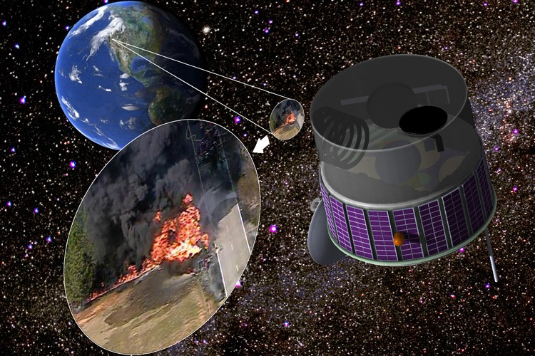
FUEGO’s objective is to detect the very beginning of wildfires in the western part of the USA from the Mexican to the Canadian borders, and from the Pacific coast past the Rocky Mountains. The satellite in geostationary orbit has an imager operating in two infrared bands (4 and 10 microns) and a visible imager for context information. The satellite will determine the geographic location of beginning wild fires, monitor their evolution, expansion, and motion direction to provide this information in almost real time to fire agencies and early responders on the ground. For more information see the FUEGO website.
PARTNERS
Fireball Information Technologies, LLC
PRINCIPAL INVESTIGATOR (PI)
Carl Pennypacker, Tim Ball (Fireball Information Technology)
TEAM
Cathy Chou, Brian Craddock, Harald Frey, Chaincy Kuo, Chris Schmidt (U. Wisc), Bill Tennant (Teledyne), Ed Wishnow